The Week Ahead - New Year In Sight
 |
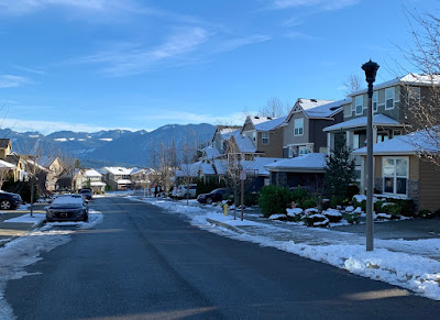
| EaglePointe neighborhood, Snoqualmie Ridge (elev ~1,100ft ) - Christmas Eve |
While most seem anxious for what 2021 will bring, in the short run it would appear more of the same, and that includes the weather pattern.
A chance of light rain Sunday morning as a weak front moves northward, though most of the precipitation should be to the west of us. We should then get some clearing later in the day as high pressure begins to build in. However, it does appear we have another round of moderate Cascadia (gap) winds to get through ~25-35 mph this evening as an E-W pressure gradient sets up shop. This one is a bit more NE-SW oriented, so areas to the north susceptible like Gold Bar may see a bit stronger winds than us this go around.
Winds should dissipate after midnight and we'll be left with relatively clear skies with areas dropping below freezing, if not early Monday, very likely early Tuesday. We should see rather sunny skies, outside of areas of fog that may form, Monday and potentially the first part of Tuesday before the next frontal system makes its way inland.
There's strong model consensus that rain returns for Wednesday, turning showery for New Years Eve on Thursday. Models are mixed at this point on lingering showers into the evening hours.
The next organized system is expected to arrive New Years Day (Friday) with another system likely on Saturday.
Temperatures look to remain around normal for much of the week with 2021 in all likelihood getting off to a wet start.
Snoqualmie Summit should build on it's ~60" base beginning with Wednesday's frontal system but snow levels are expected to lower around pass levels at best so it's possible some rain may mix in.
Stay safe and remain hopeful for better times ahead
Wishing you all a Happy New Year
Have a great week!
Comments
Post a Comment