Posts

Showing posts from March, 2019

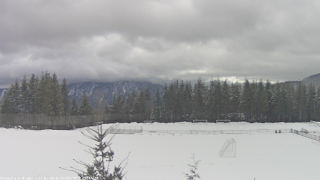
Improving weather and clocks forward should make for good timing to view a few sunrises over the Cascades!

Image
As we move towards just boring old rain or sunshine for at least the next 7-8 months, let's talk for a minute about the Sun and all its glory and beauty! Looking East - Eagle Pointe, Snoqualmie  We set the clocks forward an hour tonight so the sun will rise one hour later tomorrow (7:30 am).  Weather pending, we might be able to catch some nice sunrises in the coming days and weeks,  hopefully beginning with Sunday morning.  Not too early on a weekend, right?  That used to be 'early' before kids:) Looking East - Douglas Ave, Snoqualmie According to over 100 years of NWS data, the odds of rain for our area from mid-March to mid-April are 55-60%; and figure odds of cloud cover on the eastern horizon at sunrise is quite a bit higher.  Not exactly odds worth waking for, but if you are up.. have a look East. In about a month from now (4/8), the sun will again be rising at ~6:30 am, or the same time as this morning (3/9 pre-clock change). On the first day of summer/lo

Wet snow back in the forecast

Image
Well I was hoping to tell you not to expect any snow arriving tomorrow evening, after all it is March, but the storm track appears to be in a Goldilocks position, making landfall to our SW (OR/CA border) to send bands of moisture our way while not scouring out enough of the cold air still flowing in from the north.  An elevation event for sure and light easterly winds that would have a drying effect are expected to turn southerly upon arrival of moisture, allowing for near full precip potential.  Not a direct hit by any means, but the potential to get messy. For a base-case scenario I'm expecting 1-3" of wet snow @ elevations 500-1,500 ft in the Cascade foothills beginning 3-6pm Wed through overnight. If the storm track comes in just a bit further north than expected, that should bring with it enough warm air aloft to keep the snow only in the mountains. Will update again tomorrow Update 3/6 1:45 pm... Not seeing much change in the pattern so I'll stick with m

Snow recap for February

Image
Here's my snow recap for February 2019. The 36" that fell over 10 days (varies widely by neighborhood) almost certainly holds a multi-decade record for accumulated base at any one time. Even edging out the 35" I had tallied from the entire epic winter of Dec'08-2009, including a slushy 1" on tax day (4/15/09).

Dry but Windy this weekend..

Expecting dry but windy for a large part of the weekend ahead for Snoqualmie and North Bend. Gap winds (~30-40 mph) look set to return by Saturday evening as a low organizes off the coast pulling on higher pressure east of the mountains. It isn't a deep enough low like the one that helped to really rev up winds on Valentine's Day (55+ mph). Models show other gap wind foothill communities, e.g. Enumclaw, Black Diamond and Columbia Gorge may see gusts a bit stronger, perhaps ~50 mph.