Posts

The Week Ahead - New Year In Sight
Image
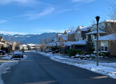
EaglePointe neighborhood, Snoqualmie Ridge (elev ~1,100ft ) -  Christmas Eve While most seem anxious for what 2021 will bring, in the short run it would appear more of the same, and that includes the weather pattern.    A chance of light rain Sunday morning as a weak front moves northward, though most of the precipitation should be to the west of us.  We should then get some clearing later in the day as high pressure begins to build in.  However, it does appear we have another round of moderate Cascadia (gap) winds to get through ~25-35 mph this evening as an E-W pressure gradient sets up shop.  This one is a bit more NE-SW oriented, so areas to the north susceptible like Gold Bar may see a bit stronger winds than us this go around. Winds should dissipate after midnight and we'll be left with relatively clear skies with areas dropping below freezing, if not early Monday, very likely early Tuesday.  We should see rather sunny skies, outside of areas of ...

Colder Air (and Snow??) Imminent!

Image
After a record setting 61° for winter solstice, we’re watching the stark rain-snow line make it’s way southeast this afternoon into evening.   A dramatic temperature drop is imminent! This is a tricky one indeed... While earlier model runs had pointed to sparse remaining moisture tonight, there’s now better model consensus that shower activity should hang around long enough to possibly see some wet flakes tonight as precipitation mixes with this incoming cooler air.  We’re not talking a freeze or icy conditions, but we can’t rule out some wet snow accumulations. So here’s the no guts no glory snow forecast- (dividing this into hilltops of Eagle Pt, Wilderness Rim ~1000 ft, and lower elevations of Snoqualmie/North Bend ~500 ft Best window for snow 6pm-midnight  @ 1000ft  -visible snowflakes, odds 60% -dusting, odds 50% -1-3”, odds 35% (rooftops and lawns) @ 500 ft -visible snowflakes, odds 50% -dusting, odds 40% -1-3”, odds 20% (rooftops and lawns) Lastly, roads are v...

The Week Ahead - Snowflakes Before Christmas ??

Image
Many out here remember the epic December snow and White Christmas of 2008, but do you remember 2017?   White Christmas 2017 Looking west at The Heights neighborhood, Snoqualmie Ridge (from Douglas Ave SE & SE Carmichael St)  For the week ahead: After another rainy Saturday that became blustery last night, we're trying to dry out this morning, in between weather systems for much of Sunday before steadier rain returns late tonight.  The mountains will be battling between rain and snow, but snowpack melt looks minor and little potential threat for river flooding at this point. As previously mentioned, another front looks set to move in later tonight into Monday bringing another good dose of rain, heavy at times Monday morning that should gradually decrease in the afternoon and evening.  Models are mixed currently as to whether or not we'll see another round of southerly winds develop Monday afternoon. Now is where things get more interesting.. An upper trough a...